Strongest typhoon in a decade hits 'China's Hawaii'
A popular tourist island south of mainland China has been hit by the most powerful typhoon in a decade, leaving the area facing potentially catastrophic winds and torrential rain.
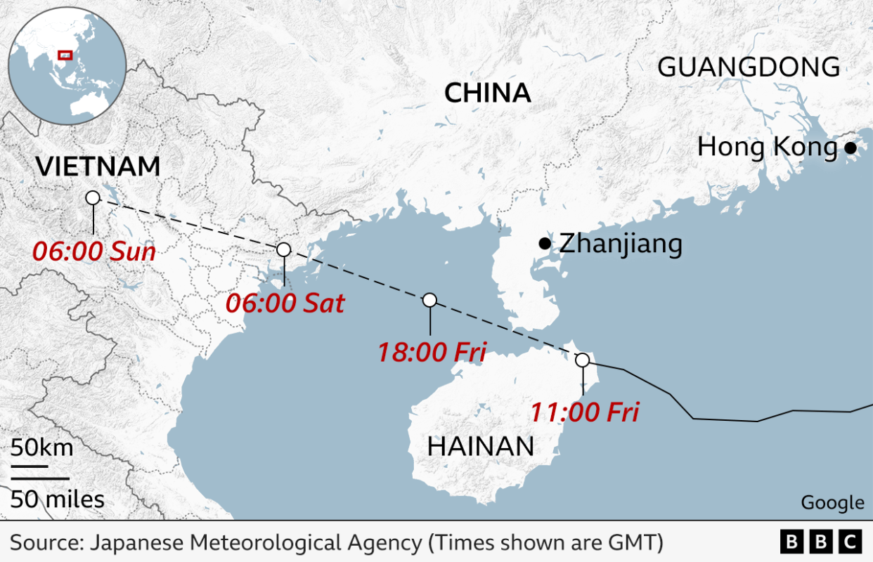
Super typhoon Yagi slammed into Wenchang city in the north-east of Hainan island with winds of 223 km/h (138 mph) at 16:00 local time (09:00 BST) on Friday, according to state media.
Yagi is the strongest to hit Hainan since Rammasun in 2014, which left 46 people dead. China's weather agency said it is the strongest typhoon to make landfall in the autumn.
Some 400,000 people in Hainan island were evacuated to safe ground ahead of Yagi's arrival. Trains, boats and flights were suspended, while schools were shut.
Yagi - which has doubled in strength after wreaking havoc in northern Philippines early this week - is the second strongest typhoon so far this year.
Meteorologists say Yagi may cause "catastrophic" damage in Hainan and neighbouring Guangdong, which is also China's most populous province.
Yagi is an "extremely dangerous and powerful" super typhoon which could make a "potentially catastrophic" landfall, the Indo-Pacific Tropical Cyclone Warning Center warned in an advisory on Thursday.
A super typhoon is equivalent to a Category 5 hurricane.
Shortly after it made landfall, Hainan saw widespread power outages, local media reported, with about 830,000 households affected. Emergency teams, consisting of about 7,000 people, said power was restored to 260,000 homes by Friday evening.
All tourist attractions have been shut since Wednesday by order of authorities. who warned of "massive and destructive winds".
With white sand beaches, luxury hotels and duty-free shops, Hainan has been dubbed "China's Hawaii".
The world's longest sea crossing, the main bridge linking Hong Kong with Macau and Zhuhai in Guangdong, was also closed. The storm made landfall for a second time in Guangdong on Friday evening, with winds exceeding 200km/h.
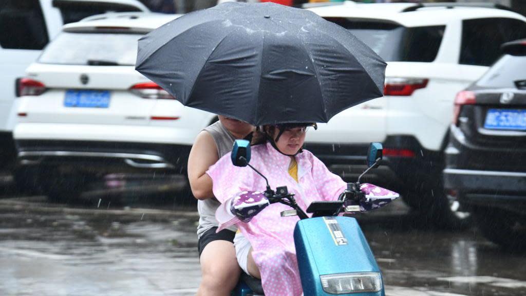
Parts of the region have been experiencing heavy rainfall and strong gales since Thursday. China's weather authority expects rainfall to reach up to 500mm.
Hainan is no stranger to typhoons. But just nine of the106 typhoons which have landed in Hainan since 1949 were classified as super typhoons, news agency Reuters reported.
Chinese authorities believe Yagi will be the strongest typhoon to hit its southern coast in a decade.
Elsewhere, in Hong Kong, trading at the city's stock exchange was suspended and schools were closed. While five people were injured by extreme weather in the city, authorities said overall damage was limited.
After hitting China, Yagi is also expected to make landfall in northern Vietnam late on Saturday in a weakened state.
Tens of thousands in the provinces of Hai Phong and Thai Binh will be evacuated to safer ground by the end of Friday, AFP news agency reported, citing local authorities.
The military has mobilised some 460,000 officers to help manage the storm's impact, Vietnamese media reported.
Vietnam's deputy agriculture minister has warned that it could hit regions "crucial to the socio-economic development" of the region.
"Carelessness could result in catastrophic damage," Nguyen Hoang Hiep said.
Four airports in the country's north, including Hanoi's Noi Bai International Airport, will be shut on Saturday in anticipation of the storm, Vietnam's civil aviation authority said.
Earlier this week, floods and landslides brought by Yagi killed at least 13 people in northern Philippines, with thousands of people forced to evacuate to safer ground.
Scientists say typhoons and hurricanes are becoming stronger and more frequent with climate change. Warmer ocean waters mean storms pick up more energy, which leads to higher wind speeds.
A warmer atmosphere also holds more moisture, which can lead to more intense rainfall.
Yagi comes a week after typhoon Shanshan hit Japan, killing at least six people and injuring hundreds.