This Special Radar Satellite Will Measure Earth’s Forests to Fight Climate Change
The European Space Agency’s Biomass mission includes worldwide involvement.
The mission plans to quantify changes to global forests over time to advance knowledge of carbon cycles.
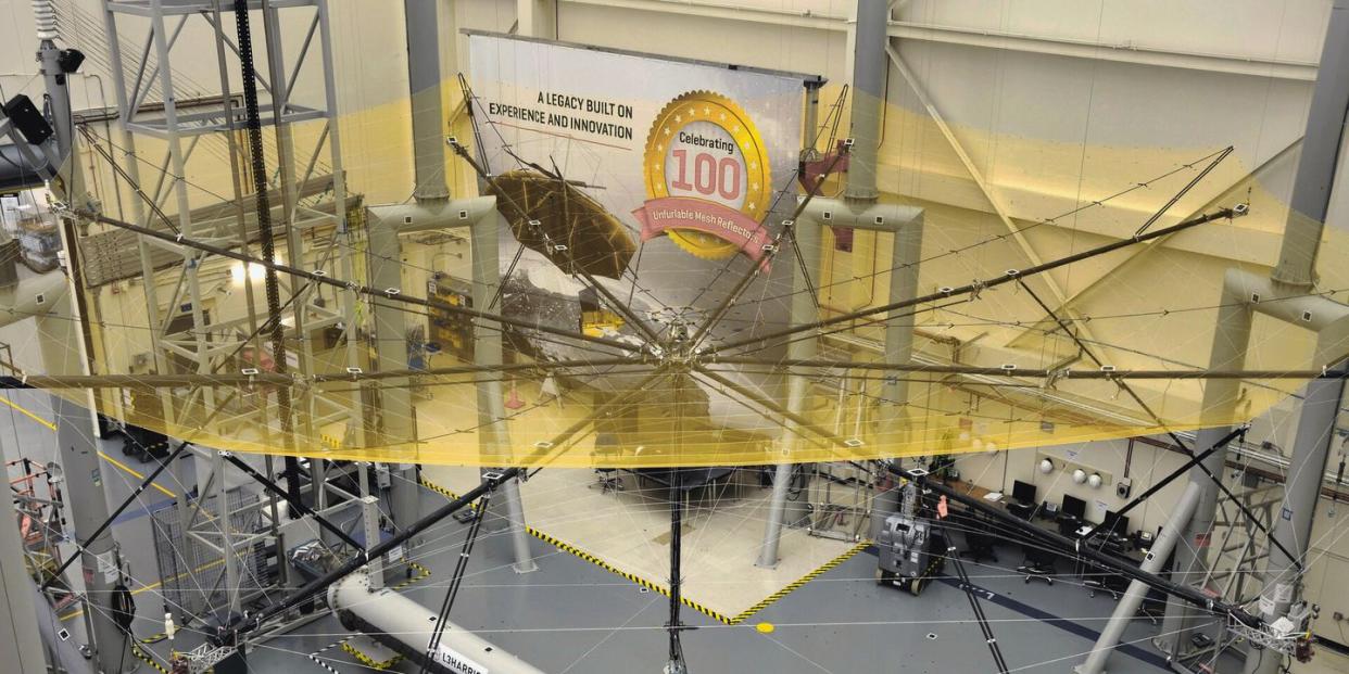
A P-band synthetic aperture radar uses a wire-mesh reflector to gather data on Earth’s biomass.
Next year, a radar reflector about as wide as a black spruce tree is tall will direct its gaze toward Earth’s forests 410 miles below.
The European Space Agency’s Biomass mission will send a 39-foot radar reflector into orbit to measure the state of our world’s forests. The apparatus will look through the leafy canopy of tropical forests to weigh out the woody biomass beneath, taking multiple passes in the very low P-band frequency to mark changes in biomass over time. This band is a special radar wavelength of about 70 centimeters that can penetrate the leafy canopy.
🌏 You want to keep up with the latest Earth news. Learn with us—join Pop Mech Pro.
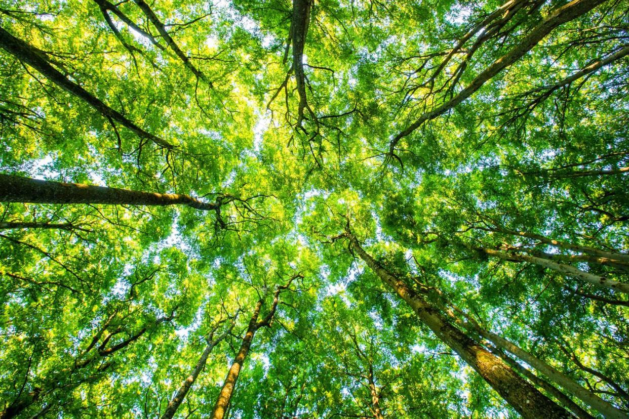
As the carbon dioxide-hungry mass of all woody plant life in an area, biomass slows down global warming. In one year, one mature tree absorbs more than 48 pounds of carbon dioxide from the atmosphere and releases oxygen in return, according to the Arbor Day Foundation. Forests absorb about 8 gigatons of carbon dioxide from the atmosphere a year. Changes to the rainforest, for example cutting down trees for farming, affects global climate negatively. However, we don’t yet know how much biomass exists in tropical forests, so scientists cannot accurately calculate how much carbon dioxide is permeating Earth and its atmosphere.
Measuring forests over a wide band of the planet takes a worldwide effort; 10 countries are involved. Planning for a launch on the Vega rocket in the latter half of 2023 from French Guiana, the satellite is currently under construction at Airbus in the United Kingdom. The antenna-reflector by Florida’s L3Harris Technologies has already been tested, in the Netherlands. “This is a particularly challenging test campaign both in terms of the size of the antenna and the very low P-band frequency that Biomass will be using,” says Luis Rolo, a testing engineer, in a news release, “which allows it to pierce through forest canopies to acquire individual trees.”
The Biomass mission plans to map the world’s trees to chart forest changes on Earth. “This reflector will receive P-band data reflected from the world’s forests, data that will carry information about forest biomass and forest height, leading to a better understanding of the state of our forests,” the space agency writes, “how they are changing over time, and advance our knowledge of the carbon cycle.”
The P-band radar technology isn’t new. In fact, it has decades of history, but for military use—it’s the same band the United States employs to watch for incoming missiles. For scientific research, the International Telecommunications Union opened a small window in the electromagnetic spectrum, even if it still precludes use in certain latitudes of the west and north. That’s fine with the researchers, though, who want to focus on the tropics and Asia, areas that aren’t already heavily mapped.
“This mission is about getting a much better handle on the role of forests, in either emitting carbon dioxide through destruction, or taking up carbon dioxide through growth,” Shaun Quegan, the mission’s principal scientist from the University of Sheffield, tells the BBC. “At the moment, the amount that’s being emitted from forests, the uncertainty on that number is 50 percent or a bit bigger, and I actually think 50 percent might be optimistic.”
The mission team expects a global map generated every six months, and five years of data collection on forest biomass and height altogether. The results will inform the creation of an accurate 3-D map of the forests.
To make it all work, the Vega rocket will launch the satellite, equipped with the L3Harris Technologies antenna folded up. Once safely in orbit around the Earth, a three-piece boom will deploy the stowed reflector bundle into position. When the boom hinges lock into their final places, the reflector bundle will get released and then opened. It will provide a “highly accurate and stable” 39-foot aperture wire-mesh reflector to receive the forest data.
Before the mission can launch, ongoing testing must ensure that the antenna-reflector can not only properly attach to the satellite’s main body, but also that it can handle the voyage to space and the unfurling process. Then it must sustain the five-year mission.
Testing of the antenna itself has been tricky, since it’s 12 meters [39 feet, 5 inches] wide, much larger than the average satellite antenna. “Usually when we test a large satellite here, its antenna is significantly smaller, typically between 0.5 and 2 metres [1 foot, 7 inches and 6 feet, 6 inches] across,” Rolo says in the release.
During its orbit, the data will arrive on a three-day repeat cycle. A transponder integrated onto a mobile positioning system inside a protective enclosure in Australia will allow it to track the Biomass satellite as it moves. The transponder antenna will reflect radar signals from Biomass back to the satellite, to help confirm the mission is operating optimally. Italian and Canadian companies helped with the technology of this component, adding to the true worldwide nature of this giant, forest-measuring umbrella.
Whatever we learn by the end of its mission, Biomass will give us a true picture of our planetary forest health and provide better data for solving the climate crisis.
You Might Also Like
