The Gulf of Mexico is blazing hot, but hurricane season is ominously quiet
The Summary
Despite high ocean temperatures, hurricane season has hit a lull.
The season was expected to be far more active than normal, and it got off to a record-breaking start.
Still, hurricane season's unofficial peak is Sept. 10, so scientists would not be surprised if cyclone activity soon ramps back up.
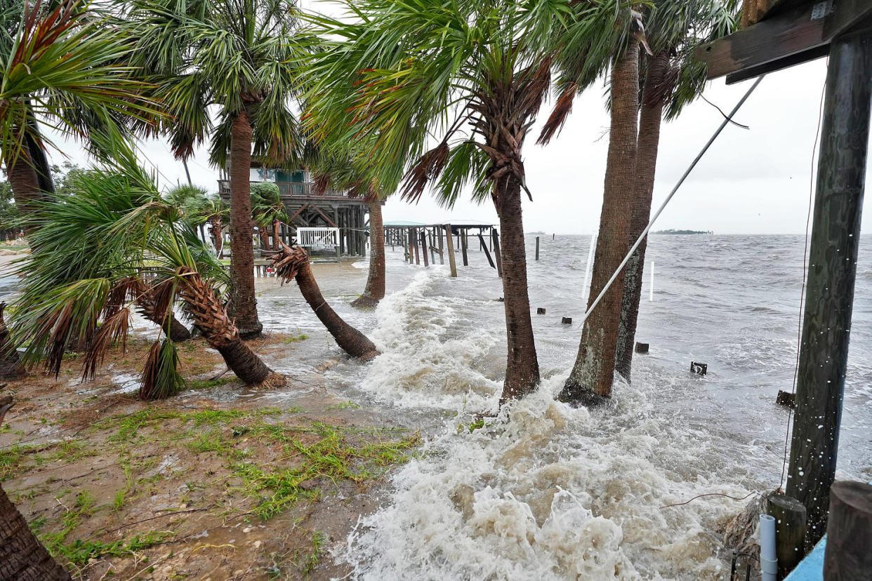
The Gulf of Mexico is blazing hot, but hurricane season — temporarily, at least — has hit a lull, a surprise to researchers who see plenty of ingredients brewing in the Atlantic but no storms on the radar.
The National Hurricane Center on Friday was not expecting tropical cyclone activity for at least a week.
“There’s nothing coming up. It’s extremely quiet, which is odd, given how hot the Atlantic is and the trend toward La Niña,” said Philip Klotzbach, a meteorologist at Colorado State University who specializes in Atlantic basin seasonal hurricane forecasts. “There’s a lot of head-scratching right now.”
The natural La Niña climate pattern, which scientists expect to take hold this fall, is closely associated with hurricanes. So are warm waters in the Atlantic, and ocean heat content in the Gulf of Mexico is the highest it has been since 2013, according to data from the University of Miami.
Sea surface temperatures in the North Atlantic were trending about 1.8 degrees Fahrenheit above normal, according to the University of Maine’s Climate Reanalyzer. The trend is especially pronounced in the Gulf of Mexico.
Warm seas add energy to hurricanes because of the additional heat and raise the risk that storms will intensify rapidly.
“There’s plenty of fuel. That’s not what’s holding the season back,” Klotzbach said.
Hurricane season begins June 1 and ends Nov. 30. Hurricane scientists predicted a record hurricane season this year, and it got off to a record-setting start when Hurricane Beryl became the first Category 4 storm to form in the Atlantic Ocean in June. Then slow-moving Hurricane Debby dumped incredible rainfall on some Southeastern states in early August. But it’s been relatively quiet since.
Steve Bowen, chief science officer for Gallagher Re, a global reinsurance broker, said trends in weather off the coast of West Africa, including an enhanced monsoon, might have prevented storms from developing into the systems that can seed tropical storms in the Atlantic basin.
But that might not last much longer. The unofficial peak of hurricane season is Sept. 10.
“It would not be a surprise if we end up seeing a quote, unquote backloaded season in which September and October and perhaps even in November are pretty active,” Bowen said.
Even with this recent lull, scientists consider this season quite active, so far.
“We’ve already had two U.S. hurricane landfalls,” Bowen said. “We typically don’t see the first major hurricane until Aug. 31. … When you’re looking at just pure statistics, we’re actually running still quite ahead of where we typically would be in an average season.”


