Hurricane Hone tracker: Latest forecast as storm gradually moves away from Hawaii’s Big Island
Hurricane Hone is gradually moving away from Hawaii’s Big Island, but tropical storm conditions will continue in other parts of the state with maximum sustained winds of 80 mph, according to the latest advisory of the National Hurricane Center (NHC).
As of 11 a.m. HT (5 p.m. ET) on Sunday, the center of Hurricane Hone (pronounced hoe-NEH) was moving westward. It's roughly 100 miles southwest of Kailua-Kona, a town on the west coast of Hawaii's Big Island, and 175 miles southwest of the state’s capital city of Honolulu.
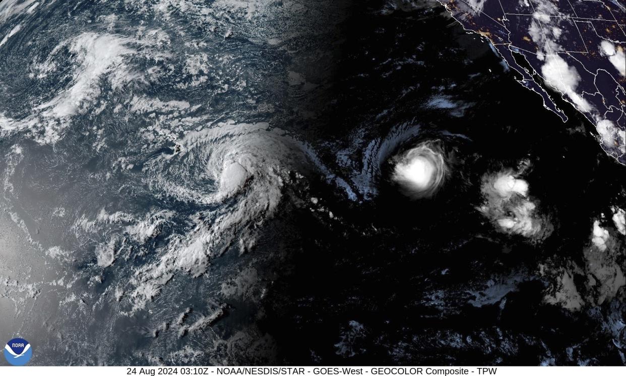
Meanwhile, roughly 1,365 miles away from Hilo, Hurricane Gilma is now a Category 3 storm and continues to move westward across the open waters of the Pacific. As of 5 p.m. ET on Sunday, Gilma has maximum sustained winds of 115 mph and is expected to remain a hurricane through early Tuesday, before weakening considerably through the end of the week, according to the NHC.
Tropical storm warnings are in effect in Hawaii County, as both storms are likely to bring rough seas and surf to the islands, posing potential danger to surfers, swimmers and small boats in the coming days.
Where is Hurricane Hone now?
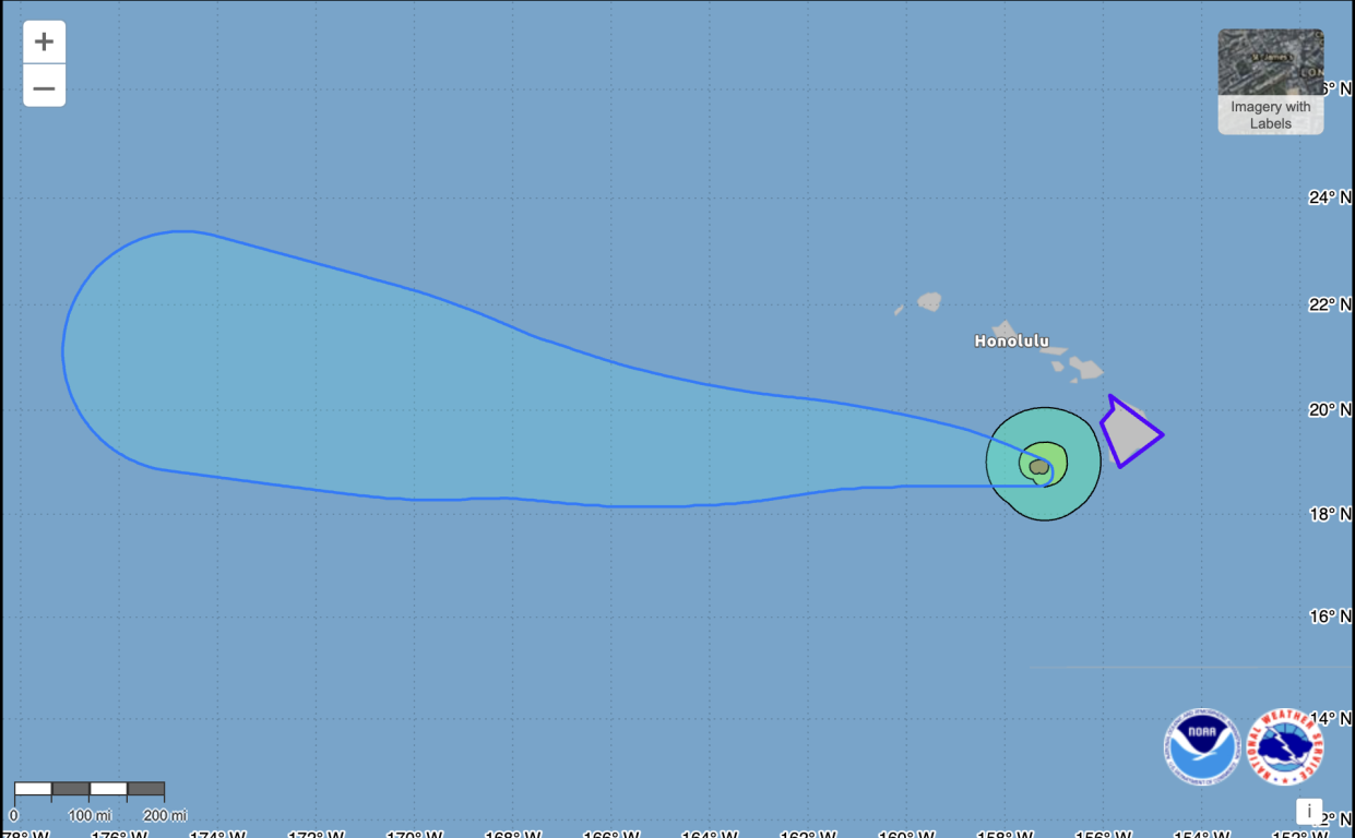
As of 5 p.m. ET on Sunday, Hone is moving west-northwest at around 12 mph and will likely continue this motion for the next few days. The center of the storm reached its closest point of approach to the Big Island at around 10 a.m. ET, passing approximately 45 miles due south of South Point, according to the NHC.
Location: Around 100 miles southwest of Kailua-Kona, Hawaii, and 175 miles southwest of Honolulu.
Maximum sustained winds: 80 mph.
Present movement: Hone is moving west-northwest at 12 mph, which will continue for a few days.
What are the watches and warnings?
Hawaii Gov. Josh Green declared a state of emergency on Saturday, allowing him to activate the National Guard and state disaster funds to expedite emergency response efforts, if needed.
Hurricane warnings, tropical storm warnings, high winds and flash flood warnings remain in effect for Hawaii County as of 5 p.m. ET on Sunday, according to the National Weather Service’s Honolulu office.
As of midday Sunday, wind gusts of 73 mph (at Kohala Ranch) and roughly 18 inches of rainfall have been observed on Hawaii's Big Island, according to AccuWeather, causing over 21,000 customers to be without power.
An additional 3-5 inches of rainfall is expected in southeast-facing slopes of the Big Island on Sunday through Monday morning, according to the NHC, with a potential 1-3 inches affecting the windward coasts of the smaller Hawaiian islands.
Closures and bus route cancellations
In a weekend weather update, Hawaii County Mayor Mitch Roth urged residents to “take necessary precautions,” warning of dangerous surf on the Big Island’s eastern-facing shores.
Waipi‘o Valley access road is closed and overnight camping at Whittington & Punalu‘u Beach Parks is canceled, according to Hawaii County’s Hazard Impact Map. Hele-On Bus Service is also canceled through the weekend and emergency shelters have opened from Ka‘ū to Hāmākua should people need them — including at Honoka'a High School cafeteria, Waiakea High School gymnasium, Kea'au High School library and others.
Visit Hawaii County’s Hazard Impact Map for up-to-date information on road closures, cancellations and emergency shelters.
What about Hurricane Gilma?
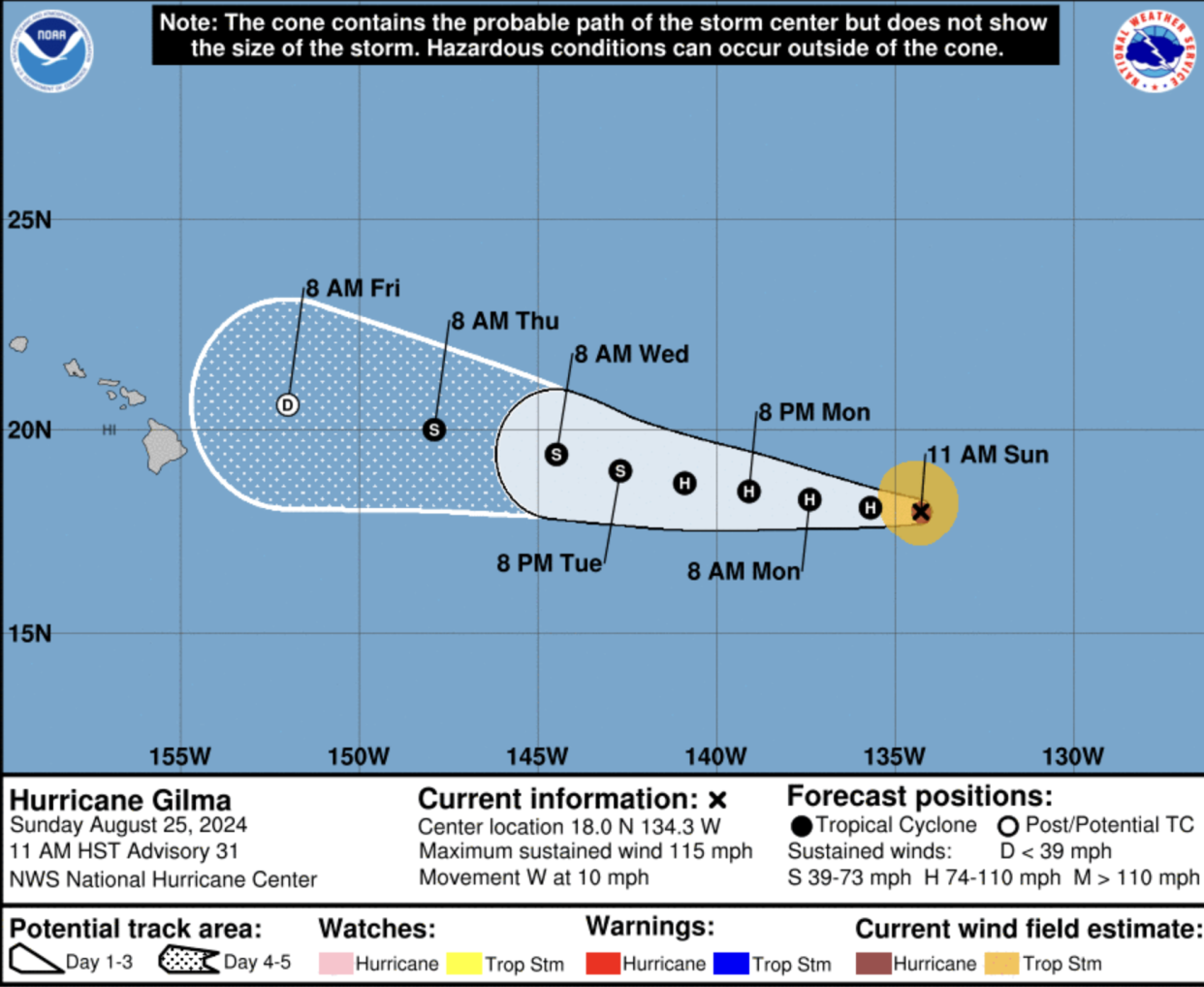
As of 5 p.m. ET Sunday (or 11 a.m.), Gilma was also moving west-northwest at 12 mph. It’s expected to continue its trajectory during the next several days, according to the NHC’s latest advisory.
Location: Around 1,365 miles east of Hilo.
Maximum sustained winds: 115 mph
Present movement: West-northwest at 12 mph
No coastal watches, warnings or hazards affecting land are in place for Hurricane Gilma, according to the NHC.


