Weather alert for thunderstorms and strong winds in North Texas Sunday evening
A weather alert issued by the NWS Fort Worth TX on Sunday at 7:32 p.m. is warning residents of thunderstorms and strong winds until 8:30 p.m. The alert is for Jack, Wise, Denton, Palo Pinto, Parker, Erath, Hood and Somervell counties.
Residents may experience wind gusts of up to 40 mph.
"At 7:31 p.m., Doppler radar tracked an outflow boudary along a line extending from near Krum to 6 miles north of Weatherford to 9 miles southwest of Dinosaur Valley State Park. Movement was northwest at 35 mph," according to the NWS. "Gusty winds could knock down tree limbs and blow around unsecured objects."
Expect thunderstorms and strong winds in the following locations:
• Weatherford, Briar, Springtown, Brock, New Fairview, Boyd, Oak Trail Shores, and Bluff Dale around 7:35 p.m.
• Decatur and Poolville around 7:40 p.m.
• Paradise, Lipan, and Cool around 7:45 p.m.
• Mineral Wells and Lake Mineral Wells around 7:50 p.m.
• Stephenville, Bridgeport, and Morgan Mill around 7:55 p.m.
• Lake Bridgeport around 8 p.m.
• Alvord and Chico around 8:05 p.m.
• Lake Palo Pinto and Huckabay around 8:10 p.m.
Other impacted locations include Santo, Cundiff, Park Springs, Lingleville, Crafton, Gibtown, Stony, Joplin, Bartons Chapel and Bennett. This includes the following highways: Interstate 35 between mile markers 470 and 472. Interstate 20 between mile markers 364 and 410.
The NWS comments, "If outdoors, consider seeking shelter inside a building."
This alert is in effect until 8:30 p.m.
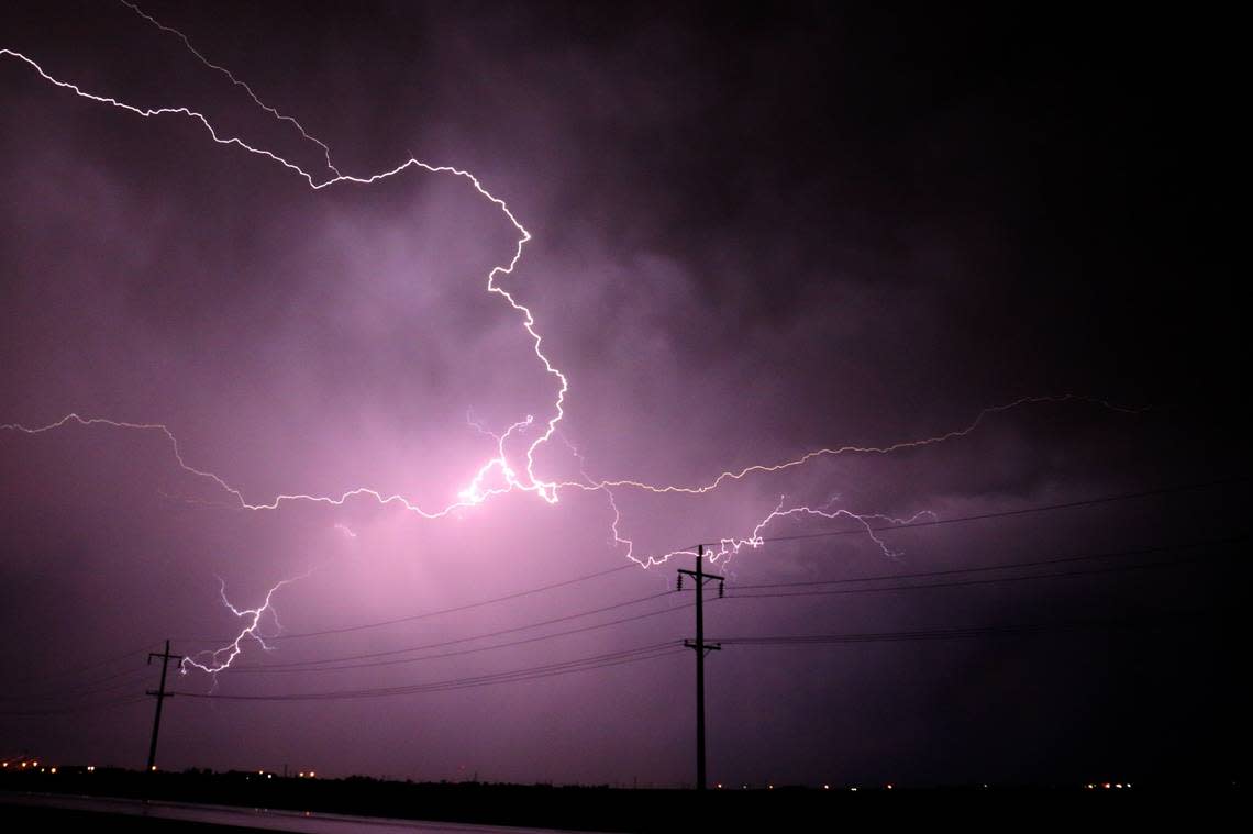
Actions to take when lightning threat is imminent
Around 25 million lightning strikes occur in the United States every year, with most taking place during the summer months. The NWS reports that these strikes result in about 20 fatalities annually. The probability of lightning strikes rises as a thunderstorm approaches and peaks when the storm is directly above. As the storm moves away, this likelihood decreases.
Here are suggestions for staying safe during a thunderstorm:
• To decrease the risk of getting struck by lightning, when you go outside, establish a plan to reach a safer place.
• If the sky turns ominous and thunder can be heard, find a secure place for shelter.
• Once inside, abstain from touching corded phones, electrical devices, plumbing, and windows and doors.
• Wait 30 minutes after the last lightning or thunder before going back outside.
If finding indoor shelter is not an option:
• Stay away from open fields, hill summits, or ridge tops.
• Avoid tall, isolated trees or other elevated objects. If you are in a forest, stick to areas with shorter tree cover.
• If you are in a group, spread out to avoid the current traveling between group members.
• If you are camping in an open space, choose a valley, ravine, or low area for your campsite. Remember, tents do not shield you from lightning.
• Stay away from water, wet items, and metal objects. Water and metal do not attract lightning but they are excellent conductors of electricity.
What steps to follow when driving in the rain?
• Turn on your headlights — Even when it's light outside, using headlights can improve visibility and alert other drivers to your presence.
• On the road — Drive in the middle lanes and stay on high ground. Rainwater tends to stockpile on the edges of roads.
• Avoid puddles — Driving into puddles or low rainwater areas can lead to vehicles hydroplaning or losing control.
• Do not follow large vehicles closely — Large vehicles like trucks or buses can create a spray of water that can reduce your visibility.
• Avoid flooded zones — If you encounter a flooded road, make a U-turn and go back. The powerful currents of flash floods can carry drivers off the road. Driving through deep water can also damage a vehicle's mechanical and electrical systems.
What is hydroplaning?
Hydroplaning is when a vehicle starts uncontrollably sliding on wet roads.
This happens when water in front of the tire builds up faster than the vehicle’s weight can push water out of the way. The water pressure then causes the vehicle to rise and slide on a thin layer of water between the tires and the road, making the driver lose control. The three main causes of hydroplaning are:
1. Vehicle speed — When a vehicle’s speed increases, the tire-traction grip and ability to control the vehicle decreases. Drive at a reduced speed during wet weather.
2. Water depth — The deeper the water, the sooner a vehicle loses traction on the road. It doesn’t matter how deep the water is, even a thin layer can lead to hydroplaning.
3. Tire tread depth — Checking your tire tread before hitting the road is important, as low or no tread can lead to sliding.
In the event of your vehicle hydroplaning, here’s what to know:
• Ease off the accelerator — Step off the gas to slow down the vehicle until the tires find traction.
• Turn into the skid — Turning into the skid can help the vehicle’s tires realign to regain control.
• Make sure the tires reconnect with the road — During the skid, wait until the tires reconnect with the road and then gently straighten the wheels to regain control.
• Brake gently as needed — Brake normally if the vehicle has anti-lock brakes and pump brakes gently if in an older vehicle.
Source: The National Weather Service
