Risk of tornadoes Tuesday in Greater Cincinnati: See what to expect and when
Update 11:55 a.m.: The National Weather Service has said the round of weather activity between 1 and 3 p.m. will not pose a serious threat.
"Based on the earlier timing, the potential for organized widespread severe weather with THIS round of activity (1-3 PM) appears lower at this time," the agency said. "Damaging winds, large hail, and tornadoes will still be possible so please stay tuned for updates later this afternoon."
See the list: Threat of severe weather prompts early school dismissals, canceled events
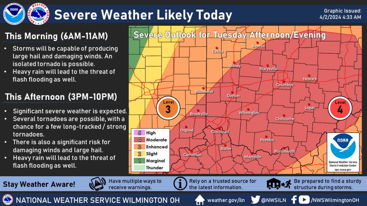
Original report: Storms capable of producing strong tornadoes are possible Tuesday, according to the National Weather Service in Wilmington, with the greatest threat in the afternoon.
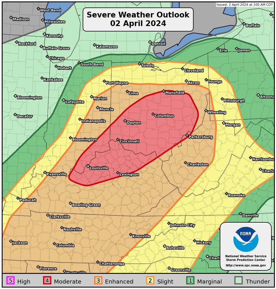
All counties in Northern Kentucky, Southwest Ohio and Southeast Indiana are under a moderate, level 4 out of 5, risk of severe weather, according to the weather service.
"Several tornadoes are possible, with a chance for a few long-tracked/strong tornadoes," the agency said.
The weather service also said the nature of the storm will make it hard to create a better timeline or predict where the severe weather will happen.
Severe Weather Discussion for Tuesday, April 2. pic.twitter.com/d30EoCbBir
— NWS Storm Prediction Center (@NWSSPC) April 2, 2024
Timeline for severe weather Tuesday
While the severe weather was initially expected to hit Greater Cincinnati later in the evening, the National Weather Service issued an update just before 10 a.m. moving the timeline up.
The agency warned that storms could occur between noon and 8 p.m. It said the weather system would not produce "linear features" that allow for a more specific timeline.
"Timing and particular threats will be storm-based and could be in multiple locations at the same time," the service said
The threat of severe thunderstorms comes with a flood watch for the region and a flood warning for the Great Miami River at Troy, Taylorsville and Miamitown as well as the Whitewater River Alpine. High winds and large hail are also expected.
What regions are under tornado risk?
The storm front Tuesday stretches from Houston, Texas, all the way north to Canada. Tuesday morning much of Kentucky is under a tornado watch. Rain is predicted along the front, but southern Ohio could be where the weather gets the most extreme Tuesday evening.
Flood warnings issued
A number of flood warnings have been issued Tuesday in anticipation of the heavy rain. A flood watch has been issued for much of the Greater Cincinnati area until 11 p.m. Tuesday.
Warnings have been issued for:
The Great Miami River at Troy, Taylorsville and Miamitown
The West Fork of Whitewater River at Alpine
The Scioto River at Piketon and Circleville
The Big Darby Creek at Darbyville
The Licking River at Newark
The warnings are set to expire late Tuesday.
What is causing the tornado risk
A cold front pushing east is causing the storms. Severe weather is expected to form along the front which extends from the Mid-Atlantic to the Ohio and Middle Mississippi valleys.
In Cincinnati, the temperature is expected to peak around 71 degrees Tuesday afternoon then plummet to the low 40s by Wednesday morning.
The low temperatures will stick around for the rest of the week with snow possible Wednesday night and Thursday morning.
Next Tuesday, April 9, marks the 25th anniversary of the tornado that struck Blue Ash. That tornado reached F4 speeds resulting in the death of four people. The weather service said the 1999 twister demolished 200 homes and another 400 were damaged.
This article originally appeared on Cincinnati Enquirer: Tornado threat in Ohio, Kentucky on Tuesday, April 2
