Rounds of severe thunderstorms may have damaging consequences in central US
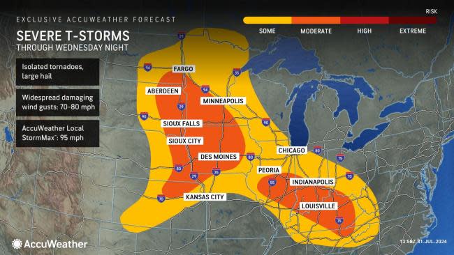
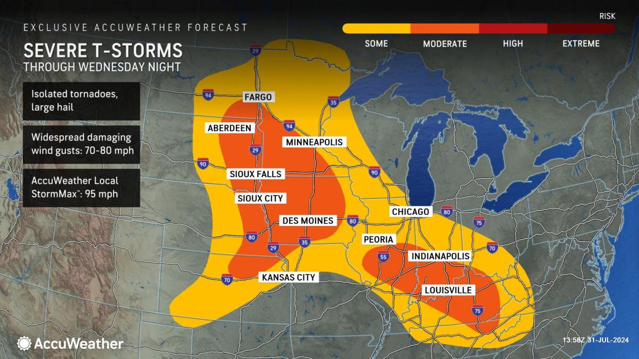
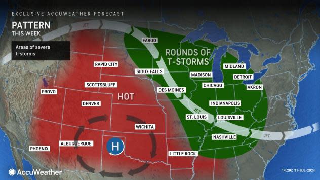
Portions of the Midwest and Ohio Valley will remain a hot spot for thunderstorms and the likelihood of rounds of severe weather this week, AccuWeather meteorologists warn.
Some locations may be affected by one thunderstorm a day through Thursday. Others may be blasted by multiple storms per day. However, the potential exists for severe thunderstorms to roll through some communities, which can be damaging.
In less than 12 hours, Des Moines, Iowa, was blasted by two rounds of severe thunderstorms on Tuesday morning. Gusts close to 60 mph occurred in the first round before daybreak but gusts close to 50 mph occurred in the storms during the midday hours. Des Moines was hit again Tuesday night with storms packing high winds, hail and torrential rain. Nearly 3.50 inches of rain fell from midnight to 6 a.m., local time, on Wednesday.
Multiple thunderstorm complexes occurred across parts of the Midwest and into the Tennessee Valley Tuesday and Tuesday night, bringing damaging wind gusts, flooding downpours and hail to the area.
 |
Another round of thunderstorm complexes moved through parts of the Midwest and Ohio Valley Wednesday and Wednesday night. These complexes brought numerous reports of damaging wind gusts and hail, including a report of a 92-mph wind gust near Hillhead, South Dakota, according to the Storm Prediction Center.
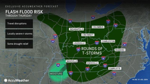
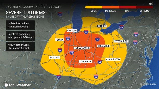
On Thursday, a broad area of the Midwest and Ohio Valley will have some risk of severe weather from eastern Missouri to western Pennsylvania, West Virginia, and western Virginia. Portions of Illinois, Indiana, Kentucky and Ohio will have a moderate risk of severe weather where storms can be more numerous. Hazards include damaging wind, hail, flash flooding and even a brief tornado or two. Thursday's AccuWeather Local StormMax™ wind gust is 80 mph.
 |
Since some of the storms may survive through the night, vivid lightning and loud thunder may keep some people awake and stress household pets.
Even outside of the prime threat zones for severe weather, heavy and gusty thunderstorms will roam portions of the southeastern and northeastern United States.
 |
For much of this week, a heat dome over the central and southern Plains will help to set off the thunderstorms, which erupt on the northern and northeastern rim of the hot air.
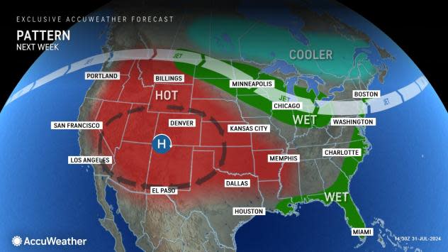
During this weekend to next week, the heat dome will broaden and extend farther west.
This change in the shape of the heat dome will shift the areas most likely to experience multiple rounds of showers and thunderstorms. The active zone is likely to extend from the Great Lakes to the mid-Atlantic and perhaps New England.
 |
However, portions of the northern Plains and the Ohio Valley may also remain active with multiple opportunities for showers and thunderstorms.
Want next-level safety, ad-free? Unlock advanced, hyperlocal severe weather alerts when you subscribe to Premium+ on the AccuWeather app. AccuWeather Alerts™ are prompted by our expert meteorologists who monitor and analyze dangerous weather risks 24/7 to keep you and your family safer.
